Places Narrative

Previous Slide
The Indian treasure fleet preparing to set sail from Lisbon (from Joseph-Francois Lafitau, Histoire des decouvertes et conquestes des Portugais dans le Nouveau monde, avec des figures en taille-douce, Paris, 1734).
Cross-cultural exchange was made easier by faster ships. The 1494 treaty of Tordesillas halved the world outside Europe between Portugal and Spain, and thus ships sailing to the East Indies left from Lisbon.
Cross-section of southern Africa, showing Mozambique on the east coast (from “A new map of Africa from the latest Observations”, contained in John Senex, A new general atlas of the world, London, 1721).
After rounding the Cape of Good Hope, merchant vessels replenished their stocks of fresh food and water at Mozambique harbor.
Engraving of Goa and its harbor (from Joseph-Francois Lafitau, Histoire des decouvertes et conquestes des Portugais dans le Nouveau monde, avec des figures en taille-douce, Paris, 1734).
Portugal kept its trading empire connected with the strategic placement of fortress towns. Goa was its major base in the Indian Ocean.
Map showing Malacca’s central position along the Malacca Straits (from Henri Chatelain, Atlas historique ou Nouvelle introduction à l’histoire, à la chronologie et à la géographie ancienne et moderne, représentée dans de nouvelles cartes, Amsterdam, 1739)
There were many pirates sailing the waters of the rich Spice Islands, thus strategic towns like Malacca were central to keeping the waters safe.
Map of Nagasaki, including site of Christian persecution (from the series begun by Joseph Stöcklein, Neuer Welt-Bott das ist: Allerhand so lehr-als geist-reiche Brief, Schrifften und Reis-Beschreibungen, Augsburg, 1726-1758)
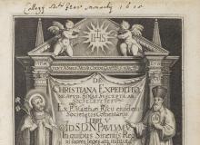
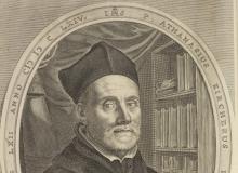
We know now of such exchange because of the fact that letters and reports written by the Jesuit missionaries overseas were collected into books and journals back in Europe, including the famous China Illustrata. The letters back and forth brought together academics from other sides of the globe.
Photograph of the façade of St Paul’s Church, Macau (photograph by Ian Fairhurst, 2006 — used with permission)
Once the Portuguese traders established their foothold in Macau in the mid-1550s, it became an important center for cross-cultural exchange and the Jesuits established colleges, churches and art workshops here.
Cities of the province of Pe-chi-li, modern Hebei (from Jean-Baptiste Du Halde’s A description of the empire of China and Chinese-Tartary, printed by Edward Cave from the French original, London, 1738-1741)
The Jesuits believed that to have the greatest effect in China they needed to have the support of the Emperor. They thus set their sights on maintaining a base in Beijing.
The fort and trading city of Batavia, now Jakarta (from Henri Chatelain, Atlas historique ou Nouvelle introduction à l’histoire, à la chronologie et à la géographie ancienne et moderne, représentée dans de nouvelles cartes, Amsterdam, 1739)
The creation of the Dutch East Indies Company in 1602 quickly challenged the monopolies enjoyed by the Iberian traders. Dutch merchants soon built strong bases in Nagasaki and Batavia.
Isle du Palais, Paris (from Michel Felibien, Histoire de la ville de Paris, Paris, 1725)
Missionaries in Asia sent back much information to printers in Europe, especially Paris, who eagerly turned these letters into books and atlases.
Map of Rome and the Vatican (from the publishing house of Nicola de Romanis, Roma compiutamente descritta in sette giornate per comodo de’ forastieri, Rome, 1842)
The Jesuits needed to convince their superiors in Rome that they were building a new church in Asia, and not just translating Chinese classics and Japanese scrolls.
Next Slide